
This blog describes our trip from Seattle, WA, to Juneau, AK, aboard the charter yacht, Ursa Major. The boat is crewed by Josh Haury (Captain for this trip) and Emily Waschak (also a licensed Captain). Both Josh and Emily took turns being Chef (both excellent chefs). Emily also served quite ably as "Ship's Bosun."
Saturday, April 30, 2011
Our trip started at 8:20 am (EDT) with our flight from Atlanta to Seattle. It was a very pleasant trip, and we arrived a few minutes ahead of schedule at 10:40 am (PDT). We took the Sound Light Rail to Westlake, then a short cab ride to the Mediterranean Inn Hotel.
We will start the travelogue with a view of the Seattle skyline. The picture was taken from the roof deck of our hotel in downtown Seattle:

And, here's a view in the other direction (looking west) looking out over Puget Sound and the Seattle harbor area:

Sunday, May 1, 2011
We awoke Sunday morning at 3:30 am ("tummy time"), dressed and went downstairs in the hotel for a Starbucks fix. Ruth discovered their raspberry scones and Caffe Mocha and was in heaven!
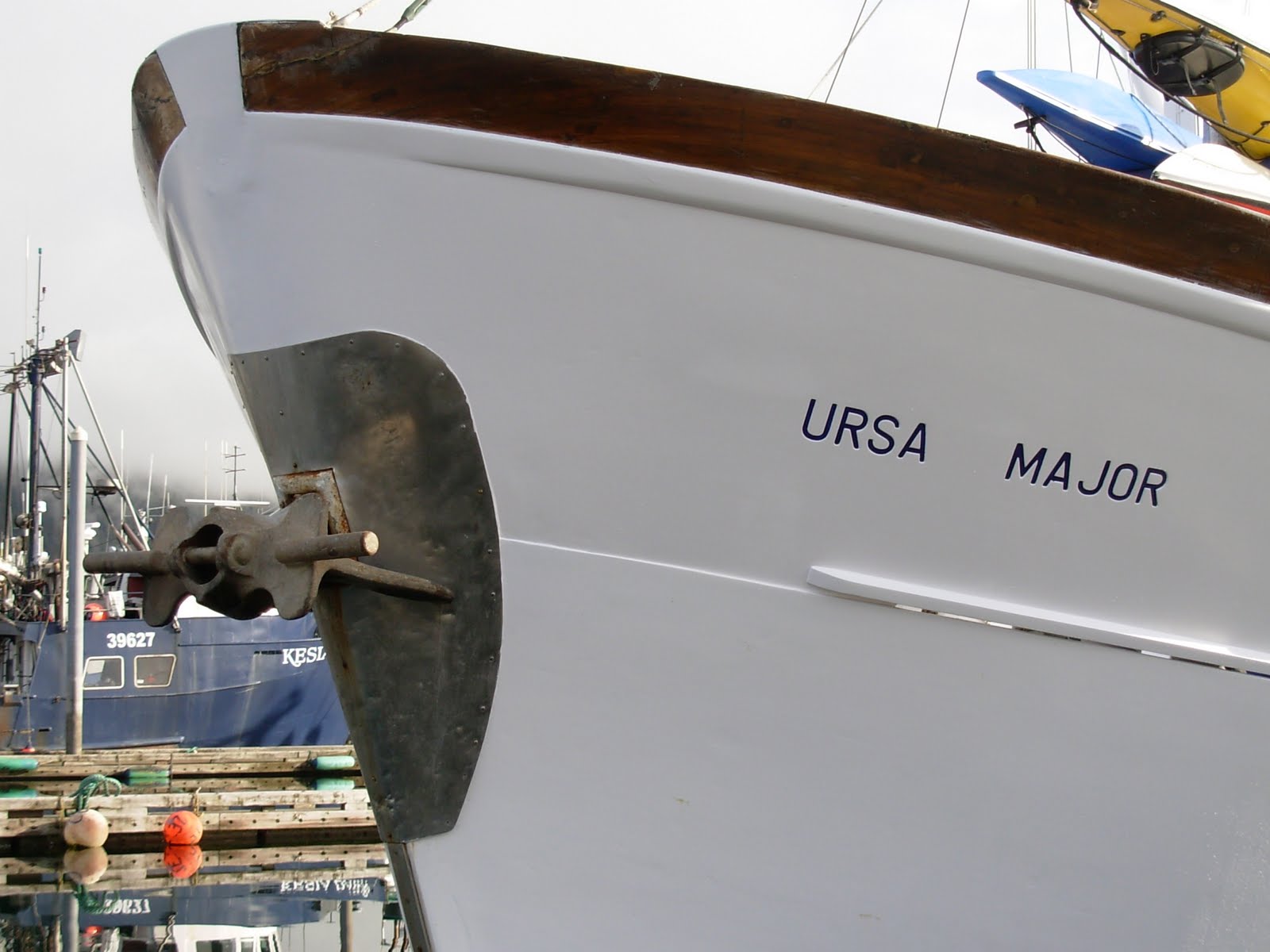
A quick cab ride to Brower Boat Yard on Lake Union, where Ursa Major was berthed, was next on the agenda. "Ursa," as we will refer to her in this blog, is a 65 foot long Malahide Trawler built in Dublin, Ireland, in 1972. She has a beam (width) of nearly 20 feett and draws nearly 10 feet (lowest point of boat below the water's surface). As you will see from the photos in this blog, she is a solid vessel and is beautifully built and maintained. We were thrilled to see Ursa Major for the first time in person!

Here is our very excellent crew, Josh and Emily. They are (finally) enjoying a cool one on the sundeck in Juneau after we completed our voyage and were securely settled into our slip. Great folks!

Ursa Major is owned by Dr. V. Joyce Gauthier of Seattle (left below). She and her sister, Gabby, (right below) came to the docks to give us a Bon Voyage! in person. It was the first cruise of Ursa since the fall:

Captain Josh was quick to get our picture right after we boarded:

Also joining the cruise were Barrie and Karen Hutchinson of Whidby Island (very near Seattle). They added a delightful dimension of fun to the trip. Here they are, also on the sundeck, enjoying a beautiful day:

We went below to our stateroom (the master stateroom on the vessel) and realized what went into that 10 foot draft -- it was our stateroom! Here's the view out our port in the en suite head:

After a short briefing (with some delightful pastries, made by the skilled hands of Emily, fruit and coffee, we got underway. We motored out the Lake Union Canal, passing a number of interesting sights, such as these "house boats" ("boat houses?") floating in the water:

Since it was Sunday morning, there was little automobile traffic to be inconvenienced by our need to have the bridges open for us to pass. Please note what a beautiful day it is! This is not all that common in this part of the world:

Barrie was already happy -- as were we all!

An interesting example of topiary sculpture along the canal. We couldn't remember ever seeing one quite as large:

Shortly, we arrived at the Lake Union Canal Lock. There was enough traffic for them to open both locks and we eased into the "big" lock with several other boats:

Bill was assigned to the stern line, while others were on the bow line and fenders.

We were lowered about 20 feet to the level of Puget Sound. We are now in salt water. Barrie and Emily prep the lines for stowage while Josh deftly maneuvers Ursa Major out into the canal:

Ruth (the photographer for this trip, as usual), thought this unusual cloud was worth a picture, while Bill continued to thrill at what a perfect weather day it was:

Our first sighting of "wildlife" was this sea lion basking in the warm sun on a buoy (look closely). He seemed to ignore us as we passed:

At various times during our trip, we would come upon a "tide-line." A tide-line refers to where two currents in the ocean converge. Driftwood, floating seaweed, foam, and other floating debris may accumulate, forming sinuous lines called tide-lines (even though they generally have nothing to do with the tide). This debris often attract bait fish which attracts birds and larger fish, making it a favorite spot to fish:

We soon saw our first ferry. This is one of the ferries that shuttle among the various ports around Puget Sound and the San Juan Islands. They are quite fast and efficient:

It was a little disconcerting at first to look our our port with the boat's wake splashing up over the edge. It looked like a front loading washing machine! However, the port was well secured an didn't ever leak:

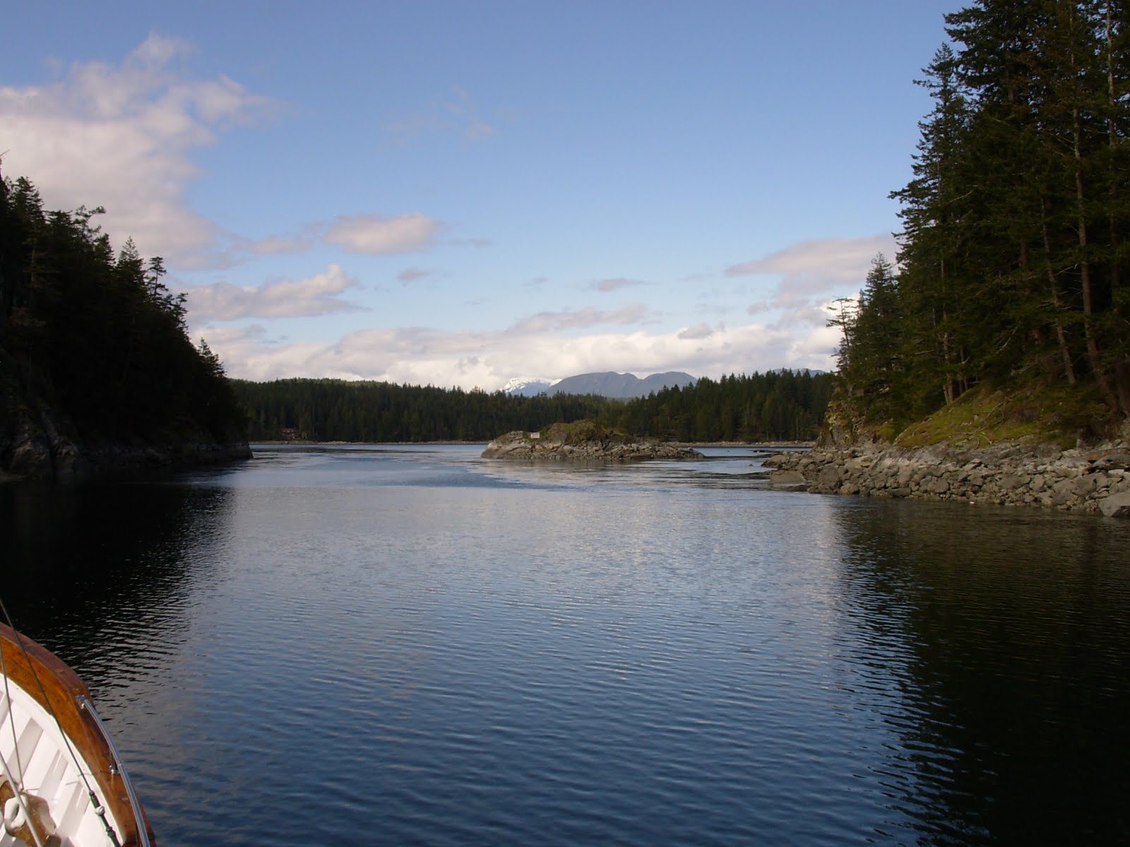
We continued on through Admiralty Inlet, past Whidby Island (Where Barrie and Karen live), through Rosario Strait and part of the San Juan Channel. The current was against us for most of the afternoon, dropping our normal eight knot cruising speed to 3.5-4.o knots at times. We anchored for the night in Parks Bay on the southeast side of Shaw Island in the San Juans. It was a very nice spot. The yellow highlight in the chart is on the bay:

Today was Ruth's birthday! We enjoyed a delightful dinner baked salmon with garlic potatoes and salad. Ruth had requested a special treat of Baked Alaska for dessert at dinner, which Josh and Emily prepared for all of us to enjoy (including Bill -- it was gluten free). Here's Ruth celebrating the moment:

And here are Emily and Josh, enjoying their culinary skills. It really was fun, and very good!

It had been a grand start to a grand voyage!
Monday, May 2, 2011
Today, we were awakened by the starting of the generator at 6:00 am (PDT now). We were underway soon after, heading north through Swanson Channel past South and North Pender Islands an Prevost Island. Emily prepared breakfast of scrambled eggs with salmon and English muffins and fresh oranges. It was another step to spoiling us by pampering us with excellent food!
It drizzled under a grey sky for most of the morning. We continued on past Galiano and Valdez Islands. We had made the comment that we didn't remember any lighthouses along the route from our previous trips. Well, Josh and Emily corrected THAT really quickly by pointing out most of the lighthouses as we went. Here is one that was easy to spot. Notice the rain on the water and windshield:

We cruised on into Dodd Narrows with the current behind us. This was going to be a wild ride. You can see the evidence of the swift current in the following series of pictures. The current got stronger as we proceeded north and the Narrows, well, narrowed:


We finally emerged from the Narrows after quite a ride. The current pushed Ursa Major like a pea blown through a peashooter! We saw about 14 knots on the GPS speed indicator. That means that our normal eight knot speed was boosted by about six knots of current! Wow!
Just north of Dodd Narrows is the pretty town of Nanaimo on Vancouver Island. We pulled into the downtown inner Basin and moored to a floating pier. Josh collected all our passports and went ashore to clear Canadian Customs. After a quick clearance, we were allowed to go ashore. We all went shopping for various items. Along the way to the store, we were treated to some really pretty plantings:


Cameron Island was the section of the harbor where we were moored:

Along the walk to the stores, we saw this electrical box, decorated with a lovely painting that blended well with the greenery around it. The Nanaimo residents seem very proud of their town:

We returned to the boat as the rain stopped. Ursa, safely in her berth, greeted us:

We enjoyed happy hour aboard, then were treated to another feast by Emily and Josh. This time, it was a pasta dish (yes, gluten free pasta for Bill) with shrimp and asparagus. The asparagus was marinated in Balsamic vinegar that added a delightful touch to the dish.
Today was Josh's and Emily's second anniversary and Barrie, Karen, Ruth and Bill presented them with a "Happy Anniversary" card and a bouquet of pink carnations. Here they are in front of the TV. The flowers lasted throughout the trip:

Below is a map of where we are tonight. Nanaimo is on Vancouver Island on the west side of the Strait of Georgia and a little south of west from Vancouber, BC. Sorry, I don't have any navigation charts of Canada.

We all turned in early to be ready for an early revile and long day tomorrow....
Tuesday, May 3, 2011
We awoke early today and got underway about 6:00 am. Captain Josh discovered this morning that our water maker was inoperative due to a serious leak, so we would have to be careful about the water usage until we could get parts shipped to us and put them in. Ah, well! Not a big deal. Today was another pretty day as we left Nanaimo harbor. Here is another lighthouse a little way north in Straight of Georgia. You may notice the water has developed a chop:

As we moved out into the Strait of Georgia and passed this lighthouse we noticed the strange shapes of the clouds. No, those aren't clouds, they're snow-blanketed mountains on Vancouver Island. Very pretty! Also, note the choppy waters. They were about two foot waves and it was a chilly but pretty day.

While we're out here in open water without much going on, let us take you on a little tour of the "common areas" of Ursa Major (other than heads and staterooms) to give you a feel for the boat.
Let's start with the operations of the boat and our Captain, Josh. Here is Josh in the pilot house, or bridge, busily controlling the boat while reading a book on his Kindle. This space is on the upper level and is the center of attraction much of the time we are underway:

This is the "Captain's Cabin" just behind the pilot house. It is a room two steps away from the helm. This picture is looking aft out the window onto the sundeck:

Looking out the port side window at the top of the ladder leading back down to the main deck:

This is a view out the bridge (pilot house) window at the foredeck. You see the two stacks of kayaks that are kept there:

This is looking out the next window. That strange circular contraption is a windshield wiper. When activated, the outside circular pane spins really fast, slinging any rain off the glass, rendering it perfectly clear (it's not turned on in this picture). The device that looks like a cell phone is Barrie's GPS that he is using as input to his navigation software (has nothing to do with the wiper, just a convenient place for the GPS):

To complete the tour of the crew at work, here is Emily in the galley, which is on the main deck, busily making cookies while Karen chats:

And, of course, Karen (to the left of picture) had to sample the result:

Just forward of the galley area on the main deck is this saloon/dinette area. We ate at the main saloon table, and this space was saved to store Bill's gluten free supplies. Here, we are looking toward the starboard (right) side of the boat:

Looking to port in the forward saloon, you can see the top of the stair, or "ladder," leading down to the living quarters below:

Here is a look down the ladder to the living quarters. It is very steep:

This is the other stair/ladder that leads up to the bridge. It was so steep that we all traversed it facing the steps, whether going up or down, hence "ladder":

The main saloon on the main deck looking forward and a little to starboard. The table is where we took most of our meals:

Swinging the lens slightly to port, we see the ever-present coffee pots, pot with water for tea and the icemaker. You can also see the stair leading to the bridge:

Here, we are looking aft out the main saloon window at the outside ladder leading to the sundeck. You can see the TV and Josh & Emily's anniversary flowers we celebrated with:

So, there is a brief tour. Now, here are some pictures of the guests doing their "thing." Very common for each of us to be doing what the pictures show.
First, Bill puzzling over his Sudoku puzzles:

And Ruth reading in the saloon. She read here, on the sundeck and in the bunk:

You've already seen Josh on the bridge and Emily in the galley and at the anchor. That crew WORKED!
And here are Barrie and Karen on the bridge with Josh. Karen spent a lot of time reading books on her Kindle. She also spent some time running on shore when we were tied up in a port. Barrie could usually be found on the bridge figuring out his new laptop computer and the navigation software he had recently bought:

As the day wore on, we eased to the east side of the Strait of Georgia and headed into "The Gorge" on Cortez Island to anchor for the night:
Emily was all set with the anchor and windlass with Karen standing by to help and watch:

Captain Josh maneuvered Ursa Major to a good spot in the anchorage, Emily let go the anchor and paid out about 150 feet of chain. We were in about 50 feet of water. Karen looks on approvingly:

Once the anchor was set, Emily secured the chain and windlass:

It was indeed a lovely anchorage:

But, Emily and Josh weren't done with the days' work yet! Next, while the passengers were relaxing with a "sundowner," Josh grilled steaks while Emily prepared delightful wild rice with pineapple and a salad. We ate like kings!
Wednesday, May 4, 2011
We thought yesterday had an early start, but today was even earlier (about 5:00 am). We hoisted the anchor and headed out of "The Gorge" into open water:

Josh deftly maneuvered toward Discovery Passage and past the town of Campbell River:

As we cruised past Campbell River and had some cell signal, Ruth had to do her "other" activity -- talk on the cell phone:

And Bill just enjoyed the beauty of the day. And it was another beautiful day:

In the picture below, you can see a tug and barge. The barge is being towed by the tug with a long wire. Actually, the wire has been shortened to give the tug better control of the barge and to minimize the space the whole rig takes:

Here is the tug by itself:

And this is the barge. It appears to be loaded with containers and trailers:

A little further north in Discovery Passage is Seymour Narrows, another spot where the current can be treacherous. Josh managed Ursa through the roiling water:


The current was with us, fortunately, or we would still be struggling through. A picture of the chart plotter on the bridge told the story. Look closely at the right side of the screen. You can make out the line in red that says, "SOG:13.7 kts." That's how fast we were going. "SOG" is "Speed Over Ground." This all means the current pushing us was about 5 knots (about 6 mph). Sorry the picture is not better:

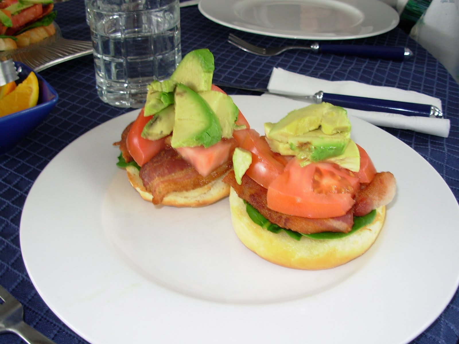
Lunch today was an unusual and special treat. It was "BSTA" sandwiches (Bacon-Spinach-Tomato-Avocado instead of BLT). They were quite yummy, colorful and a fun twist on the more mundane BLT:

Everyone enjoyed the meal:

Emily had even made a special version with gluten free bread for Bill (thanks, Emily):
As the afternoon wore on, the skies became a little greyer and we soon made our port for the night, the town of Port McNeill. We headed into harbor:

It had been a long day and two days since we walked land, so several of us left the boat to stretch our legs. Josh, Bill and Barrie got the hoses and took on water (water maker broken, remember), Emily began preparation of supper, Karen went for a run and Ruth walked around the harbor taking pictures. She had to have a picture of these flowers:

This was an unusual sculpture in the little park next to the harbor:

This park bench is carved from two logs:

Also in the park was this old steam engine on skids, probably used for logging decades ago:

Port McNeill is served by a regional airline that flies float planes. Here, you see one of the planes loading passengers. No, the plane is not tipping over, the pilot does that on purpose to make it easier to board:

After everyone was back aboard and had had a brief happy hour, Josh and Emily served us all a dinner featuring risotto and mushrooms, with a dessert of homemade ice coconut milk (as opposed to ice cream). Yum!
It had been a long day, so everyone retired early....
Here is where Port McNeill is located:

Thursday, May 5, 2011
It is very strange and unusual, but we seem to have failed to take any pictures for today. We took some 850 pictures on the trip and none are missing, but none are dated today.
So, instead of pictures, we will quote from our written log:
Super early up this morning (4:45 am) due to long day expected and poor weather forecast. Today we would traverse Queen Charlotte Sound, a long run of open water with some high winds and big seas predicted. We cast off and headed north from Port McNeill. Breakfast, to be expedient was choice of cereals and home made muffins. Emily is quite good at baking things.
We stowed all gear and loose things in anticipation of heavy seas, and weren't disappointed once we got out into Queen Charlotte Sound. The wind was more westerly than we really wanted and the seas were on our port quarter. Ursa rides pretty well in following seas. The swells were about 10-12 feet with a long period, and there were smaller waves on the swells. While we rolled a bit, the worst was one of about 25 degrees.
After a few hours of stinky seas and threatening weather (not much rain), we ducked into Fitz Hugh Sound and continued north. We had lunch of salad greens with pink salmon and cheese toast. It was a really great combination!
Much later, around 7:30 pm, we turned into the bay at Sheerwater across from Bella Bella and moored at the Sheerwater Marina (not much of a marina, it seemed). It had been our longest daily run -- 120 miles. We had halibut for supper to celebrate. Delicious!
Here is a map showing where Sheerwater is:

Friday, May 6, 2011
We were underway from Sheerwater at 6:15 am. Before long, we passed a small pod of Orcas (Orca whales, also called "Killer Whales"). A little rough through Milbanke Sound, then breakfast of scrambled eggs with cheese, bacon and English muffins). Emily called it "Americana" breakfast.
In spite of a rather foreboding sky, it was pretty as we cruise up the Sound:

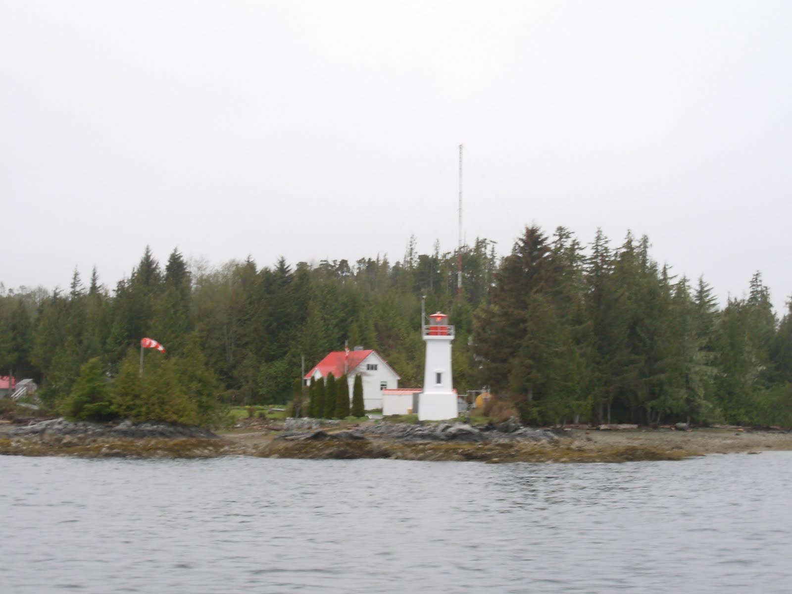
We continue to pass lighthouses, and Ruth continues to get pictures of them. This one seemed like it was more traditional:
As we proceeded, there were waterfalls and low hanging clouds everywhere. There was a breeze on our port quarter, but not so strong as to be bothersome. The British Columbia scenes were awesome:

There was a lot of socializing on the bridge. Here, Karen nurses a cup of tea as we all swap stories:

the waterfalls were full from the recent rains:


We soon arrived at an abandoned salmon cannery. It was dilapidated and getting worse. We were amazed there was a boat moored at the rickety dock. The cove the cannery sat in was pretty:

Right next to the cannery was this beautiful waterfall. Josh said the cannery used to use it for hydroelectric power, as well as a water supply for the local folks:

And more waterfalls -- each one was unique:

A longer view of a waterfall. No, this is not black and white photography, the sky cover makes it look like this:

This site was very funny. There were about 30 seagulls standing on this log with a duck at the right end. It looked like a giant rowing shell for birds:

The BC Ferries are virtually cruise ships and ply these waters at all hours carrying vehicles, passengers and miscellaneous cargo from port to port. Since there are no roads in these mountains and among the islands, these ships serve as the "highway."

We cruised through Princess Royal Channel and Findlayson Channel. Lots of waterfalls. Halibut/pineapple sandwiches for lunch. Dall Porpoises all around today. Nice run. Made anchorage in Coughlan Bay on the BC mainland near Hartley Bay. It was a very pretty anchorage -- sorry we got no pictures!
We had homemade chicken soup for supper with ice coconut milk (ice cream) for supper. Very good! We all turned in with visions of tomorrow's arrival in Alaska in our minds....
Here is where we were anchored. You can see the dotted line marking the BC/Alaska border at the top. Hartley Bay and our anchorage are in the lower right corner:

Saturday, May 7, 2011
We got underway from the anchorage in Coughlan Bay pretty early (6:15 am again) and headed through Grenville Channel -- very narrow. As we entered the Channel, the clouds hung low. This is very typical of this part of the coast.

We spotted our first pod of whales this morning. They were Orca, often called "Killer Whales." They are very skittish usually, so it is hard to get close enough for a picture. Even if you do, they are quick and you have to snap the photo quickly, or you just take a picture of where the Orca was a few seconds ago:


Before long, we spotted another Orca. This one seemed to be alone, which is rare:

The British Columbia coast delivered magnificent scenery as we traversed Malacca Passage and went into Chatham Sound:


The day was quite pretty, and we felt we had the world to ourselves. Here is the view back over our wake from the sundeck:

Our destination for the day was Prince Rupert. There was fog in spots as we approached:

And another light marking the channel into the harbor:

We met this Canadian Coast Guard buoy tender as it left the Prince Rupert harbor. She must have just taken on fuel, and provisions based on how low in the water she was riding:

Prince Rupert is a major seaport for this area. Very large container ships can load and unload at the port's docks:


And up ahead is the "town" part of Prince Rupert.

This is the Prince Rupert Rowing and Yacht Club. This was our destination for the day:

Capt. Josh maneuvered Ursa Major alongside the outer dock and we got a good opportunity to get some more pictures:


This is the "PRRYC" (the Yacht Club) facility. Not very fancy, but functional:

It was fairly early in the afternoon, so we took advantage of the time to do some shopping and walking around town. Karen and Emily went for a run. It was a very pretty afternoon and almost warm. Prince Rupert keeps their town very clean and nicely decorated. These lamp post flags were in abundance through the streets:


We happened upon a "sunken garden," the sign said. It was pretty and also fun to walk through:


As we walked along the waterfront, we spotted these interesting sculptures. The red and green things are imitation ATONs (aids to navigation). The helmsman...well..., see the next picture:

This plaque sort of explains the purpose of the helmsman (remember, click on a picture to see it bigger):

And Ruth had to have a little fun with him:

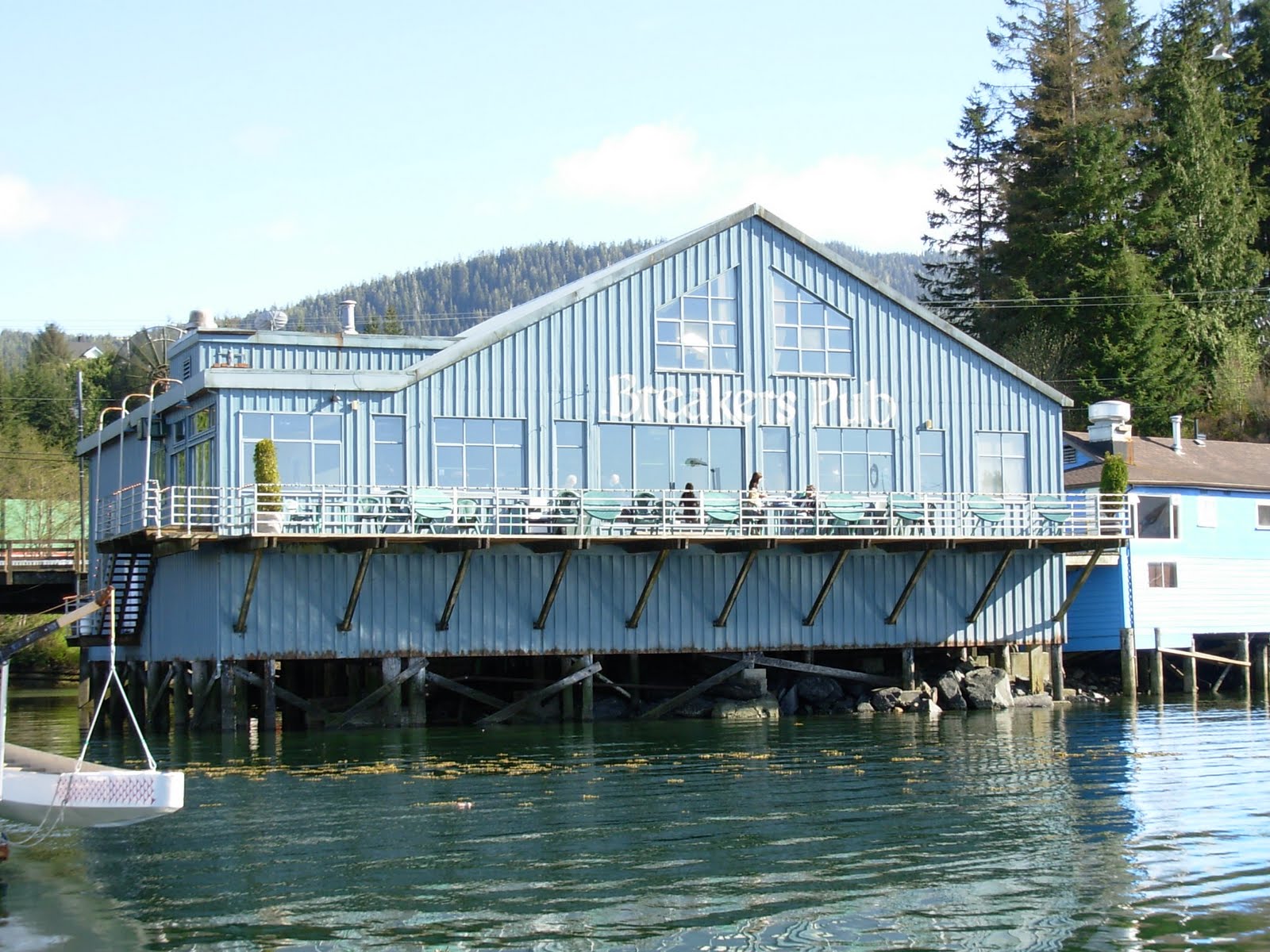
We all finally wandered (Karen and Emily ran) back to the boat for a short Happy Hour, then headed to Breakers Pub for a "Chefs' Night Off" celebration. We all thought Josh and Emily deserved it.
And here is where we are moored tonight. Just north of Hectate Strait and east of Dixon Entrance. On the left of Dixon Entrance is the vast Pacific Ocean. Prince Rupert is highlighted in the upper right corner. Again, the dotted yellow line at the top of the map is the U.S./Canada border.

We were all a bit excited when we awoke this morning about 4:30 am, because today we would be entering Alaska! Just the name brings excitement. We were underway just as the sun was rising behind the clouds:

The day was generally grey, with a spot of blue peeking out from time to time:

We passed this impressive lighthouse. It is on a tiny, rocky island. We forgot the name of the island.

We cruised up Chatham Sound, and the across Dixon Entrance, where the seas were on our beam. That made us roll a bit. It didn't last long, as we soon were in Nichols Passage heading north. Emily prepared turkey sandwiches for lunch. The sun had come out and it was only partly cloudy. The day really turned pretty.
Around 2:30 pm (Alaska time now), we entered Ketchikan harbor. We knew we were in "tourist country" when we spotted the cruise ships:

This second ship was moored very close to where we wanted to put Ursa Major. It was a Disney boat:

We were told this unusual craft was an experimental vessel built for the US Navy. It was a pontoon boat design, and very, very expensive to build. It has no practical use or market, so it will be scrapped. No comment.

As we drew closer to the docks, we could see downtown Ketchikan.

We passed under the bow of the Disney boat (it is named "Disney Wonder"), and moored at the dock just ahead of it:


As soon as we moored, a number of things happened -- the Customs and Border Patrol officer came aboard to put us through immigration and customs (we passes OK), a service technician came aboard to repair a faulty refrigerator and the watermaker, and the passengers (Ruth, Bill, Karen and Barrie), took off to town to sight see and watch the tourists. Well, yes, we were tourists, too!
Ruth snapped this photo of Bill being attacked by a stuffed bear:

Ketchikan has a number of totem poles and wooden sculptures of unique style. Here is a fairly modern carving of an eagle:

And this is a totem pole in tribute to Tlingit Chief George Kyam. It is the second one erected in Ketchikan -- the first one was removed due to age:

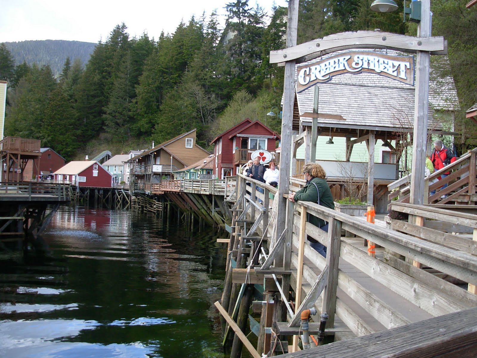
Creek Street is an infamous row of shops built along and over a creek. It is really a boardwalk, not a street. The tourists flock to these shops because they sell mostly authentic Alaskan wares. Yes, we bought some gifts for folks back home.
And, how does one introduce this amphibious tour boat/bus? What to say...

Ruth is a true gardener and loves ferns. She insisted on getting several pictures of the bank of ferns along Creek Street:

This is a picture of the "fiddle heads" growing new ferns. You can see where they get their name:

There is a tramway that runs up the hill behind Creek Street to a hotel. Ruth braved the free ride to the top and got this view:

This is the tram on the way up to retrieve Ruth. It operates just like an elevator:

We finally tired of doing touristy things and walked back to the boat. We got this close-up picture of the "bulbous bow" on the Disney Wonder. This giant metal bulb smooths the bow wave when the boat is cruising and saves an amazing amount of energy -- believe it or not:

After an enjoyable happy hour, we feasted on grilled salmon prepared by the deft hands of Chef Josh. The watermaker had been repaired and so had the refrigerator. We were "good to go."
Here is where we are tonight:

Monday, May 9, 2011
Today we got underway from Ketchikan at 6:15 am. It was a quiet, calm day as we headed north up Tongass Narrows and into Clarence Strait. Emily prepared a big delightful breakfast of bacon and eggs with onion, peppers and goat cheese. Here's Emily creating those good things:

The scenery as we cruised was breathtaking! We got dozens of pictures of snow covered mountains like these:

And there was another lighthouse we had to capture on digital media:

We spotted several whales as we cruised. They were mostly humpbacks, but then we saw two fin whales, also called finback, razorback or common rorqual. These whales grow to be nearly 88 feet long -- second longest of the whales. They weren't really close to us, but we were nonetheless able to get some pictures:


Around mid-afternoon, we dropped anchor in Ratz Bay on Prince of Wales Island. Here's the versatile Emily securing the ground tackle. It had begun to drizzle a bit:

The bay was delightfully peaceful and quiet. This is our view from Ursa Major's deck:

Although the light drizzle was persistent, it didn't dampen this crew's spirit a bit! We proceeded to get the kayaks and gear down in preparation for a little paddling. Here's Ruth looking very official:

Karen and Barrie were no less official-looking:

Josh prepared to launch the tender and the kayaks:

Ruth says, "Yep! Fits just fine!"

Here's Karen hooking up the skirt with Emily's assistance:

Of course, Karen had to chronicle Barrie's launch. Note it is still drizzling a bit:

And here he is, all set:

And Ruth is last one in:

You haven't seen Josh or Bill boarding kayaks. That's because they went in the tender and put out three crab traps in hopes of catching some dungeness crabs. Here is a pretty good picture of Ursa Major from across the bay. Too bad it wasn't a sunnier day:

After a couple of hours of paddling and setting traps, we all converged back at Ursa Major for happy hour and a supper of homemade clam chowder.
The weather had kicked up a good bit of wind in Clarence Strait, just outside our little bay, and a small fishing boat had ducked into the bay to get out of the weather. He unwittingly anchored for the night too close to one of our crab traps, and we would discover tomorrow that he had gotten tangled up in the float line to the trap.
But for tonight we were snug in Ratz Bay, which is highlighted on this chart. Note Petersburg in the upper center of the picture, and Ketchikan a little southeast of the bay. Prince Rupert is way down in the lower right:

Tuesday, May 10, 2011
We were up at 6:00 am this morning, and went to retrieve the crab pots. The pots have to be marked with the fisherman's name and his license number. Bill had been selected to be our "fisherman." Here's a picture of the label:

Sadly, as stated, a little fishing boat had gotten his anchor line tangled around the float tether to one of our traps. There were no crabs in the trap, but who is to say it had anything to do with the tangled lines? A second trap was also empty, but the third hit pay dirt:

Well, there were five crabs in it. Three of them were "keepers," one was too small and one was a female (illegal to keep). That's a female on the right:

You have to measure each crab to be sure it exceeds the minimum measurement of 5-1/2 inches:

Here are the crabs all cooked and ready to be picked. Talk about fresh! We were excited about the three good ones. Half a crab makes a pretty good serving of meat.

We got underway, headed for Petersburg, AK for the night. The seas in Clarence Strait were on our starboard quarter -- not a bad ride for Ursa Major -- but the day was sort of dreary.
We had a variety of cereals and fruit for breakfast, and later in the morning headed into Wrangell Narrows, a winding, narrow channel with lots of current when it is running strong. Here's the entrance:

We have heard Wrangell Narrows is nicknamed "Christmas Tree Channel" because of all the red and green markers that mark the channel. At night, the markers flash red and green, hence the name:

As soon as we were in the Narrows, Emily called us to a lunch of grilled ham and cheese sandwiches with all the "fixin's." Yummy!
Soon, we arrived and moored in Petersburg, AK. We love this town for several reasons. First, the cruise ships don't stop here, so no tourists to crowd the nice shops. Second, there is a strong Norwegian community here that gives the whole town a festive atmosphere. We were going to have to miss their annual "Little Norway Festival," which is supposed to be really fun. Third, the citizens of Petersburg take great pride in the decorations, art and cleanliness of the town.
We took advantage of the town laundromat and did a couple of loads of wash. Meanwhile, we took a walk around town to sightsee.
Following are some pictures of various scenes around town. It is hard to believe the little town has only 2820 inhabitants. Many buildings sport murals with various scenes:


And there is sculpture, starting with totem poles:

Fish sculpted from metal:

And a tribute to the Norwegian fishermen:

This is a replica of a Norse ship:

Many of the homes had decorative shutters:

Another "sculpture":

When we got back to Ursa Major, we noticed how clear the water was in the harbor (clear, clean water in a city's harbor is rare). The light was just right to get a picture of Ursa's 6 foot high rudder and propeller:

Remember the crabs we harvested this morning? Well we had crab for supper, and it was really delicious! It was extra special since we had caught them ourselves. Well Josh and Emily showed us how. After supper, we walked the docks to look at all the various fishing boats and pleasure boats. We snapped this peaceful scene as the sun was setting:

Here is a map of where we are tonight. You can see Petersburg in the lower right, Glacier Bay National Park in the upper left, Juneau at upper center, and Sitka at left center:

Wednesday, May 11, 2011
[There are 36 pictures in today's blog. Enjoy!]
We slept late this morning (up at 6:00 am), and were greeted with a robust breakfast of scrambled eggs with cheese, hash browns, toast. With full tummies, we went on an early morning shopping trip to the local merchandise store to get various "things."
It was impressive looking up at Ursa Major's bow as we left the boat:
We passed more sculptures in town. This is a statue in tribute to "Bruno" -- we weren't afforded a story about him:

We saw more banners like those in Prince Rupert. Somehow, these seemed more festive:

Back at the marina, we recognized this boat. It is "Northern Song" an 84 foot steel boat that we saw first in Bellingham, WA in 2009. At that time it was owned by NW Explorations, a charter company based in Bellingham. Since then the boat was sold to the current owner, who lives aboard with his family. It is a very fancy and pretty boat.

Back aboard the boat, we were underway about 9:30 am (not a long shopping trip). Capt. Josh headed the boat north up Frederick Sound. It was a pretty morning with the dramatic mountains in the distance:

We passes several ice chunks, sort of floes, that were once "calves" from the glaciers.

Even digital technology can't capture the fantastic color of this ice:

Here's a close view of the ice under the water's surface with the sun shining through it. Beautiful!

About this time, we noticed this unusual terrain and tree growth on the high shore:

Emily got out the fish net as Josh maneuvered Ursa Major close to a piece of ice:

Once on deck, the ice served very well in our drinks, including iced tea, soft drinks and "10-and10s," (10 thousand year old ice and 10 year old Scotch). The ice is so dense, it doesn't melt very fast at all.

We had a good lunch of homemade clam chowder, and right after lunch, we entered Thomas Bay on the Alaskan mainland, and put out three shrimp traps. Here's Emily waiting for Capt. Josh to give her the word to "heave-ho:"

Josh maneuvered down to the southeast arm of the bay and anchored in about 70 feet of water (the bay was quite deep). The first thing we noted was this black spot on the beach. It was a black bear foraging around:

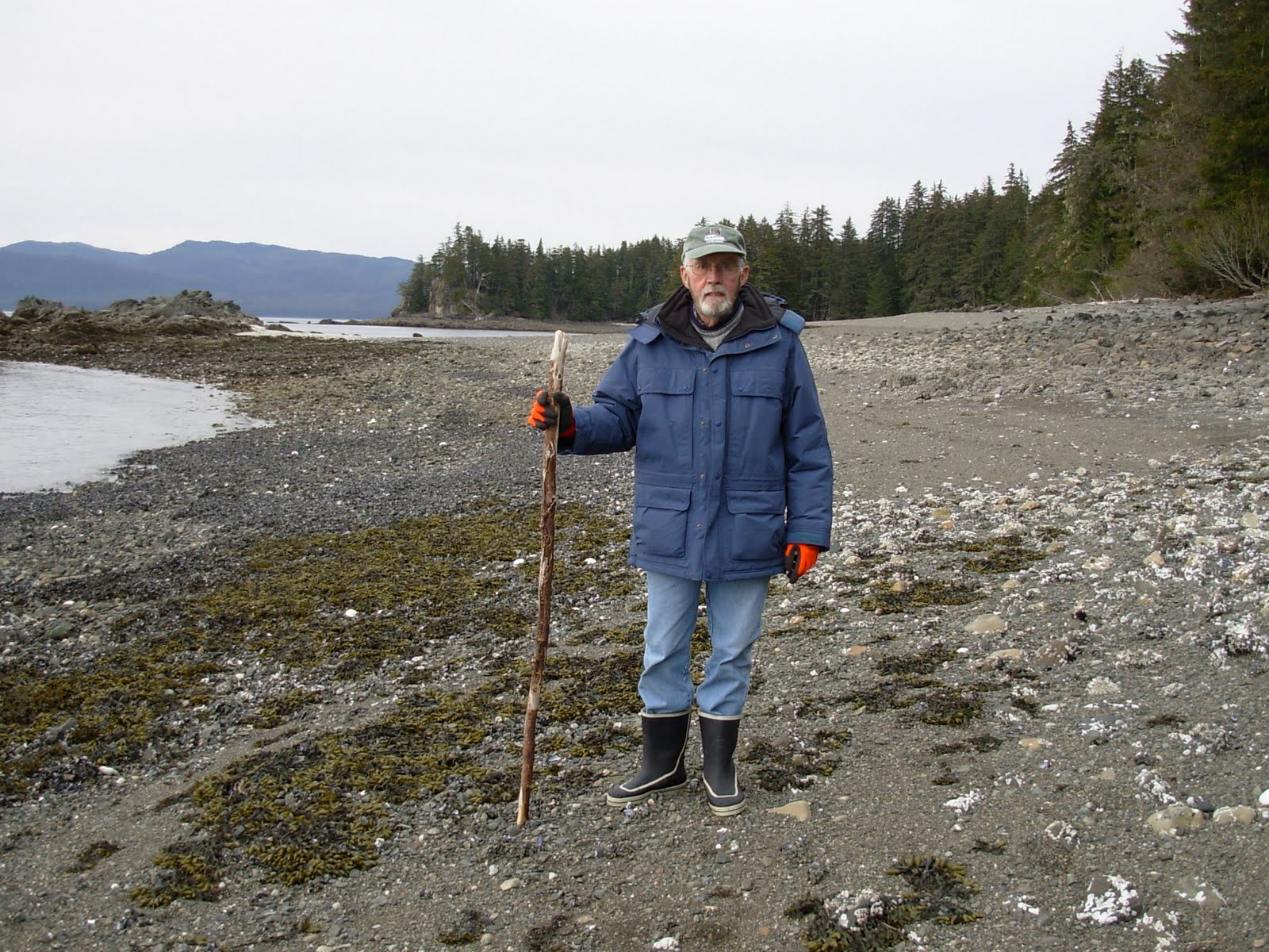
We put the skiff in the water and motored ashore (all except Josh). After securing the skiff to a couple of big rocks, and assuring ourselves the bears had wandered off, we hiked inland and found ourselves in a beautiful rain forest:

There was a trail that had been maintained quite well -- including the removal of trees that had fallen across the path:

The flora and fauna was very different from what we were used to back home. Here are some fresh "Western Skunk Cabbage" plants growing in the moist soil. Yes, they smell pretty bad (to humans):

Due to the very moist atmosphere, there are many varieties of fungus. Here's one example growing on a rotting log:

These wooden beams were actually steps placed along the trail to make it easier to walk without eroding the trail. Note the rather robust stream in the upper left:

Looking down, one could see the stream as it met the bay:

We grew more and more appreciative of the trail-makers as we hiked along. Here, they had put down wire mesh to aid in solid footing:

Along the way we were rewarded with this pretty waterfall:

And, by now, we were appreciative of this resting bench. Thanks, trail-makers!

Here is an unusual view of Ursa Major, anchored in the bay far below:

Rain forests are impressive with their plentiful growth. This one was even more impressive:

And we weren't to the top yet. More steps...

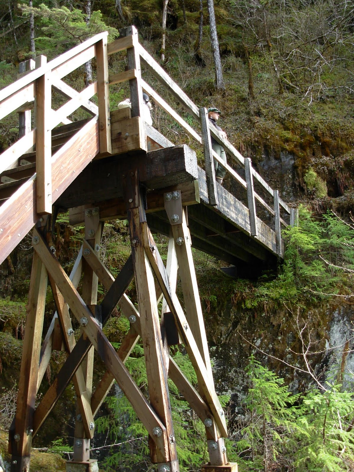
We were impressed with the care that had been taken cutting and fitting the beams that formed much of the trail:

The trail turned to steep steps right against a sheer rock wall:

At the top of the steps was a footbridge across the stream. Here's the view from the bridge:

And there were more specimens of Skunk Cabbage...pretty:


Mossy and cool. That described the area:

Here is a look at the well-engineered bridge across the creek. That's Emily enjoying the view:
Looking back at the sheer cliff we walked beside:

Mosses were everywhere:

Of course, Emily and Josh had visited this area many times, so knew how impressive it was. Everyone enjoyed the fresh air and delightful hike. It doesn't get any better that this!
We walked back to the shore and shoved off for Ursa Major. It was getting toward late afternoon and we were tired. We took the skiff and set out the three crab traps with high hopes. After happy hour, we had a dinner of pasta with beef stew on it and "flan" for dessert.
The evening sunset was a perfect cap on a perfectly fun day:

Here is the map showing where we are tonight. Harris bay is highlighted in yellow with a circle around it. Notice Petersburg isn't very far to the south, and you can see Juneau and Glacier Bay to the north:

Thursday, May 12, 2011
We slept late again this morning (until 6:00 am) and awoke to a steady drizzle. Emily greeted us with breakfast of pancakes and fresh fruit. Yes, gluten free pancakes, and they were delicious!
We checked the crab pots, and were a little disappointed. We caught one big male and four females. The big male will make a nice appetizer for us all, but the females went back in the bay.
Then we checked the shrimp traps. The traps were set very deep, so the aft winch was used to haul all that line and Emily neatly coiled it in a big pail as Josh tended the incoming pots:

It was soon obvious that we would have better luck on the shrimp than we had on the crabs:

The first thing Emily snatched from the trap was this unlucky fish! We'll throw this guy back:

Emily and Josh worked hard rinsing off the pots and cleaning out the traps:

We got 46 spot prawns -- a nice haul! We'll eat well tonight!

As we turned to leave Thomas Bay, we caught this glimpse of Baird Glacier -- very low to the water. Yes, it was a gloomy and rainy day:
 .
.We cruised up Frederick Sound, tossing blue M&Ms (yes, the candy) to "chum" for whales. Who knows if that works, but Josh thought we should try something to attract the big mammals. Sadly, it didn't work very well, as we only spotted one humpback in the far distance -- too far to get a picture.
We thought it would be fun to get some pictures of aspects of cruising on Ursa Major that most folks don't see. First, here is our usual view from the starboard wing of the bridge toward the forward part of the mai deck:

Josh has several native carvings on the "dashboard" at the helm. Here is a hummingbird:

A couple of fish, carved in a similar style:

And another hummingbird similar to the first:

In spite of our poor result hunting whales, we did see wildlife today! As we approached The Brothers Islands, we came to this big outcropping of rocks, literally covered with sea lions!

The rookery is apparently a fairly permanent colony at this time of year (we saw a similar sight on our trip in 1999 at this same spot). Here is the head bull sea lion, holding forth over his harem -- and the wannabe head bulls. They were noisy:

With all the wildlife around, Emily served us lunch of roast beef sandwiches and salad on the bridge. That was an unusual treat for us -- and good!
Soon, we turned in between East Brother Island and West Brother Island and felt our way to a little embayment that was well protected on most sides. We dropped anchor and lowered the skiff. Karen, Barrie, Ruth and Bill donned life jackets and climbed aboard with our tour guide, Emily, and headed for the shore (no bears today). Josh stayed behind to stand watch. We were going to explore another area of first growth trees, mosses, lichen and fungi. Here are a couple of prime examples:


Here are Bill, Barrie, Emily and Karen, deep in the woods (Ruth is behind the camera):

The woods were very green, moist, quiet and beautiful:

All forms of fungi seemed to abound:


A little further along the route, the terrain steepened into a real climb. Here, Bill clambers for the top to join Karen and Barrie:

Looking back, we get a nice view of Ursa Major, riding on the hook with Josh standing watch:

There was a small stream running down the hillside. The water was the color of strong tea due to the tannins that leach out of the deadfall around the rain forest:

Back down at the shore, we have this view. It is a very rocky "beach":

Here's Bill. After this picture, Ruth said, "Bill, SMILE!"
Soooo, Bill smiled:

We collected shells, as every good beachcomber does...

It had been sort of a strenuous hike, so we motored back to the "Mother Ship":

Remember that 10,000 year old ice Emily harvested yesterday? Well it had been waiting for happy hour tonight, and Bill wasn't going to disappoint it (or himself):

Happiness in the happening:

Happy hour was followed closely by a delightfully prepared dinner of crab canapés and a main dish of spot prawns and fresh cut vegetables. Yes, we ate like royalty:

Rightfully, Emily and Josh got their share:

And Karen and Barrie didn't hold back, either:

And, as if that weren't enough, dessert was a wonderful strawberry-topped decadent cake-like delight (cant remember what Emily called it).

It had been an eventful and long day, so we turned in. Here is where we are tonight. The yellow highlight is Brothers Islands. You can see Juneau in upper center and Tracy Arm to the right. That's where all the famous pictures of Sawyer Glacier are taken by the tourists:

Friday, May 13, 2011
[Lots of pictures of whales today, folks!]
We awoke about 6:15 am to a bright, clear, sunny morning. A gentle breeze from the north kept it beautiful all day. We hauled anchor and headed east from the Brothers Islands, across to Five Fingers Island, where this lighthouse stood guard. It was by far the biggest and most complete complex we had seen. Josh said until recently, it had been some sort of Coast Guard station:

As we turned northward, the view was breathtaking!

A little closer...you can see the shadows of the clouds. It was a perfectly beautiful day!

Karen and Ruth were VERY excited by the scenery.... Who says you can't relax in a lounge chair except on a cruise ship?

And the views just kept getting better:
We spotted more ice "burgettes." The entry into Tracy Arm is just to the right of the picture:

The shoreline in the area displayed some unusual looking cliffs:

WHOA! What's this? WHALES in the distance! We actually saw some 6-8 whales during the day...

Then, we happened upon two whales in particular -- apparently a mother and her adolescent youngster. They were both pretty playful, and not at all concerned about our presence. Here, the youth slaps the water with his fin:

He kept up these plaful shenanigans for at least 20 minutes. Josh stopped the boat and turned off the engine so we would not frighten him away. He became even more playful, diving and swirling in the water right next to the boat:


It was as though he were dancing for us -- putting on a show for the show's sake:


A final broach, and he was gone:

Josh's had a very fancy camera that could take pictures very rapidly, and he got some very good ones. Here are some of his:


What a show! We were all awe-inspired! But, they were gone.
We had an unusual lunch (at least for Southerners) of halibut tacos. It was another great Emily meal!
We cruised a little farther northward and headed into the inlet into Taku Harbor -- a popular bay that afford lots of good anchoring space:

There was one other yacht in the harbor. We had seen this boat a couple of times before:

There is a fishing camp and docks on the shore. We didn't see much activity:

We had dinner of black cod, mashed potatoes, green beans and an excellent wine selected by Chef Josh. Karen and Barrie were having fun -- as we all were!

It had been a perfect day -- the weather, the scenery, the whales, the company -- we all rated it an "11" on a 1-10 scale!
We turned in for the night under a bright moonlit night -- tomorrow we would arrive in Juneau!

Here's a map of our location tonight. Again, Taku Harbor is highlighted in yellow, Juneau is in the upper left and Sawyer Glacier is in the lower right. It isn't marked on the map, but Mendenhall Glacier is a little northeast of Juneau:

Saturday, May 14, 2011
We were both sad and excited when we awoke this morning at 6:00 am. We had a quick but delicious breakfast of smoked salmon fritata, fresh fruit and bagels. We were underway at 7:20, headed out of Taku Harbor and turned north into Stephens Passage.

As we cruised, we saw two whales blowing in the distance and we wondered if they were the mother and young one we saw yesterday.
Not wanting us to get hungry, Emily served us all a brunch of fresh cut carrots, celery, hummus, coffee cake and so forth. We gnashed happily on it.
Soon, we spotted the marker on George Rock, marking the rock and the entrance into Auke Bay, where Ursa Major would be moored for the coming week:

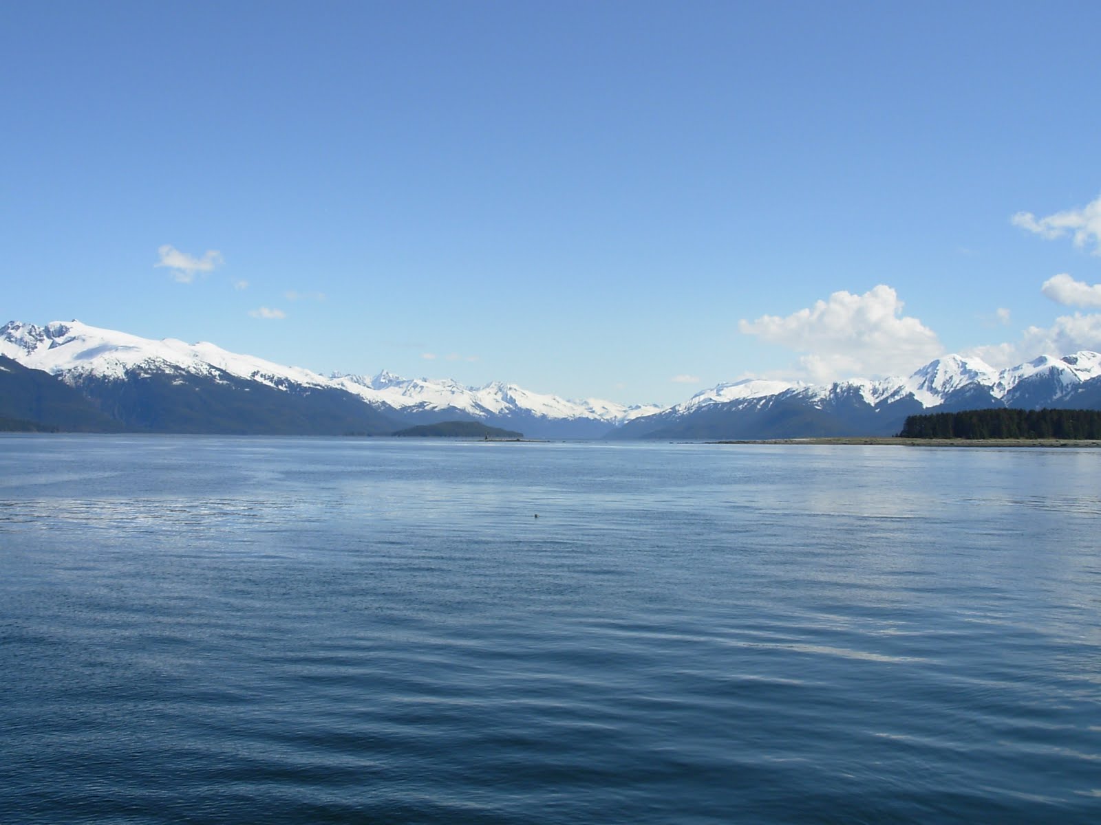
Drawing closer to the marina, we enjoyed this final view of the Alaskan Mountains. At the base of the mountain near the left is Mendenhall Glacier. What a way to finish a delightful trip!

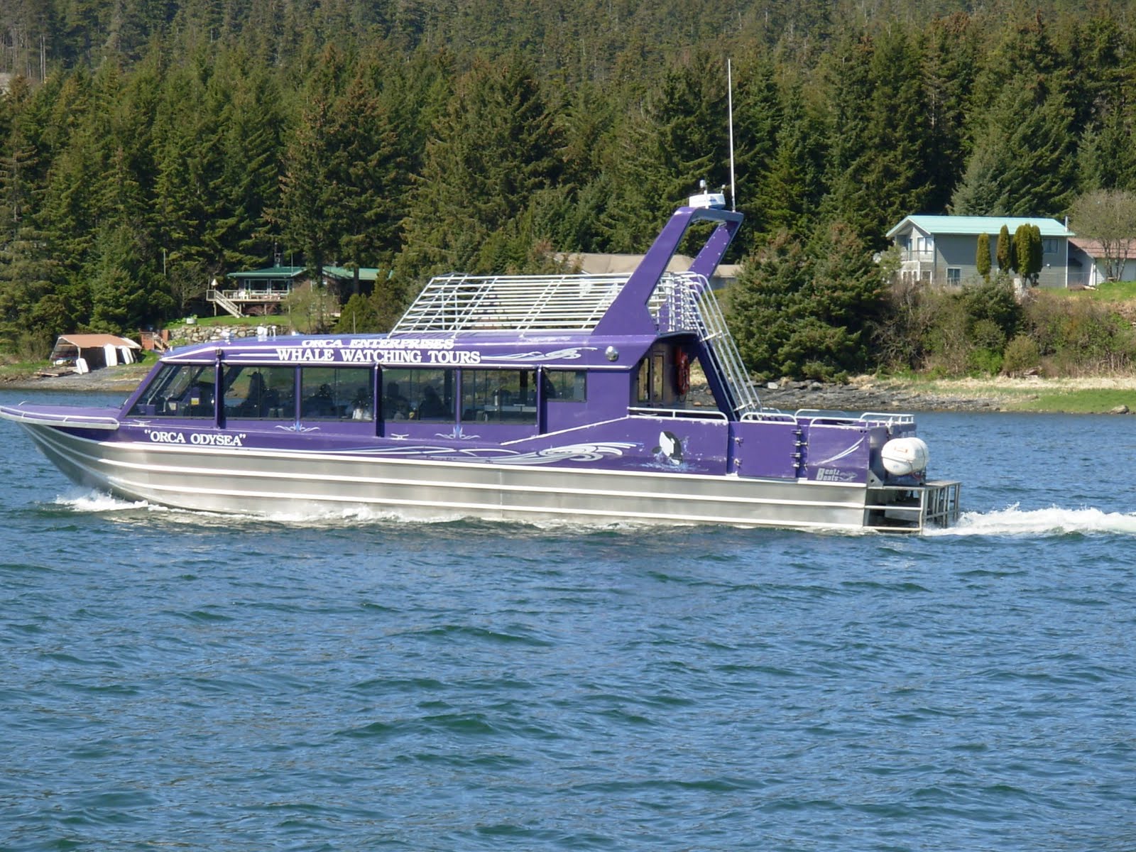
Shortly after noon, we motored into Auke Bay, our final destination aboard Ursa Major. As we entered, we saw this whale watching tour boat headed out. They didn't have a very big group aboard, but we were confident they would see whales today:
Ruth and Bill smiled at the name of this boat. They had cruised America's Great Loop in their boat named "Integrity:"

Josh maneuvered Ursa Major into her slip, Emily tied her securely, and we broke out the celebratory beer and wine! This is the first time we had seen Josh and Emily really relax over an adult beverage. It was fun to salute their achievements:

Bill saluted with wine (gluten free):

And, once again, Barrie and Karen enjoyed the moment as well. Ruth was behind the camera, but she, too, had a cool one.

Josh took this "group photo" of his passengers. This picture will go into Ursa Major's "memory book" of the trip:

The plans from here were to catch a hotel shuttle van to our hotel in downtown Juneau (the "Juneau Hotel," of all names). Then Ruth and Bill wanted to go see the Mendenhall Glacier, while Barrie and Karen wanted to "play tourist" downtown. We agreed to meet back at the hotel later for happy hour.
Ruth and Bill took a taxi ($$$$) to the glacier and did a walking tour of the area. This plaque sort of provided an overview of the glacier and the land around it:

We decided to take the walking trail out to the glacier and Nugget Falls, and impressive-looking feature we could see in the distance:

Along the way, plaques highlighted interesting things along the trail, such as the glacial scars in this eons-old igneous rock:

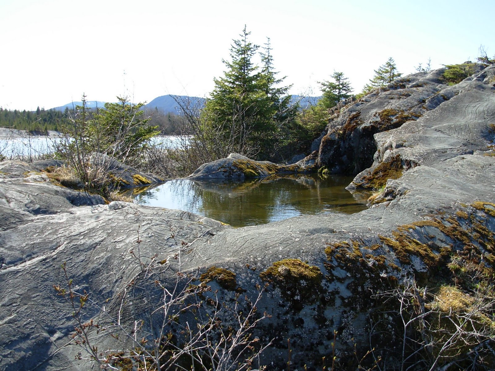
Here and there were pools of water -- not from run-off, but from rain. They were pretty:
As we got closer, we could see the icebergs and Nugget Falls better:

Here is a classic view of the glacier. The pictures don't give the true feeling of how large it is:

Look closely and you will see blue signs. These mark off a protective Arctic Tern nesting ground. People are not allowed inside the rope barrier. The Arctic Tern has the longest migration of any known living thing -- some 44,300 miles annually, round trip. They migrate from Antarctica to the Arctic and back each year. They are also one of very few birds that can hover in flight (as does the hummingbird).

We have been walking for a while now, and can finally tell we are getting closer to the falls:

Almost there. That yellow spot in the picture is Bill:

Being glacial by source, the water has a milky cast, caused by the silt in the water:

The cliffs are a study in rock and erosion. The striations offer faults that allow the winter ice to break pieces off:
 .
. 
And here is Bill, scavenging among the rocks looking for pretty colors and unusual shapes:

Once we tired of the falls and surrounding area, we walked back to visit, The Visitor Center. It was very well organized with displays. That was on our list of wildlife to find on this trip...success! Here's the Visitor Center:

This is the panoramic view from the Visitor Center. They had a couple of telescopes trained on the glacier and mountainsides. Through one, we spotted two Doll Sheep! Doll Sheep were on our list of wildlife to find on this trip. Once again, success!

To save the $$$$ we hurriedly walked a mile back down park roadway to the closest bus stop. We really hurried to catch the last bus of the day, but made it! Back at the hotel, we enjoyed happy hour with Karen and Barrie for the last time on this trip. Their flight back to Seattle was early in the morning, and we were staying another day.
We bid them farewell and safe travels....
Emily had been kind enough to make a "CARE" package of special gluten-free foods for us to take with us. We decided we were pretty tired about now, so we made supper in the kitchenette in our hotel room. It was very nice and we silently thanked Emily for yet another well thought out meal.
We had a free day tomorrow to explore Juneau before we had to leave the morning after. We turned in and were asleep in no time.
In keeping with our habit of showing you where we were each night, here is where we are tonight. While the map says "West Juneau," the highlighted area is the center is downtown Juneau, where our hotel is. Also highlighted is Auke Bay, where Ursa Major is tonight.
G'nite, Ursa, Emily, Josh, Karen and Barrie. It was fun to cruise with you all!

Sunday, May 15, 2011
We awoke a little later than usual this morning and had breakfast in our room. The kitchenette (actually a full kitchen) made it easy. We packed a picnic lunch and some snacks and struck out on foot to play "tourist" in Juneau. One of the first things to catch our eye was this statue of a humpback whale, recently placed in front of an art museum:

We wanted to visit the Alaska State Museum, and weren't disappointed. It was huge and full of interesting displays. The native history and artifacts took most of the three stories. Here are some examples of the well-done displays:


There was a circular ramp between the first and second floor. There the visitor could see displays of various animals, terrain and birds, such as this eagle's nest display:

They had just opened a new area that was dedicated to the history of photography in the area. Stereoscopes were featured in several cases:

After spending most of the morning in the museums, we walked down to the waterfront where locals were enjoying this perfect weather day. We decided to have lunch and do some people-watching.

A look up the Gastineau Channel reveals these float planes and ferry wharf. The planes take tourists on flights up over the ice fields and glaciers. They are very popular:

A look southward down the Channel reveals the cruise ships. There are sometimes five of these monsters in the harbor on any one day. Imagine the crowded shops!

This is a statue of Juneau's most famous dog, Patsy Ann. She was deaf from birth, yet could "hear" steamship whistles long before they entered the harbor. She was the official Juneau "greeter," by decree from Mayor Goldstein in 1934.

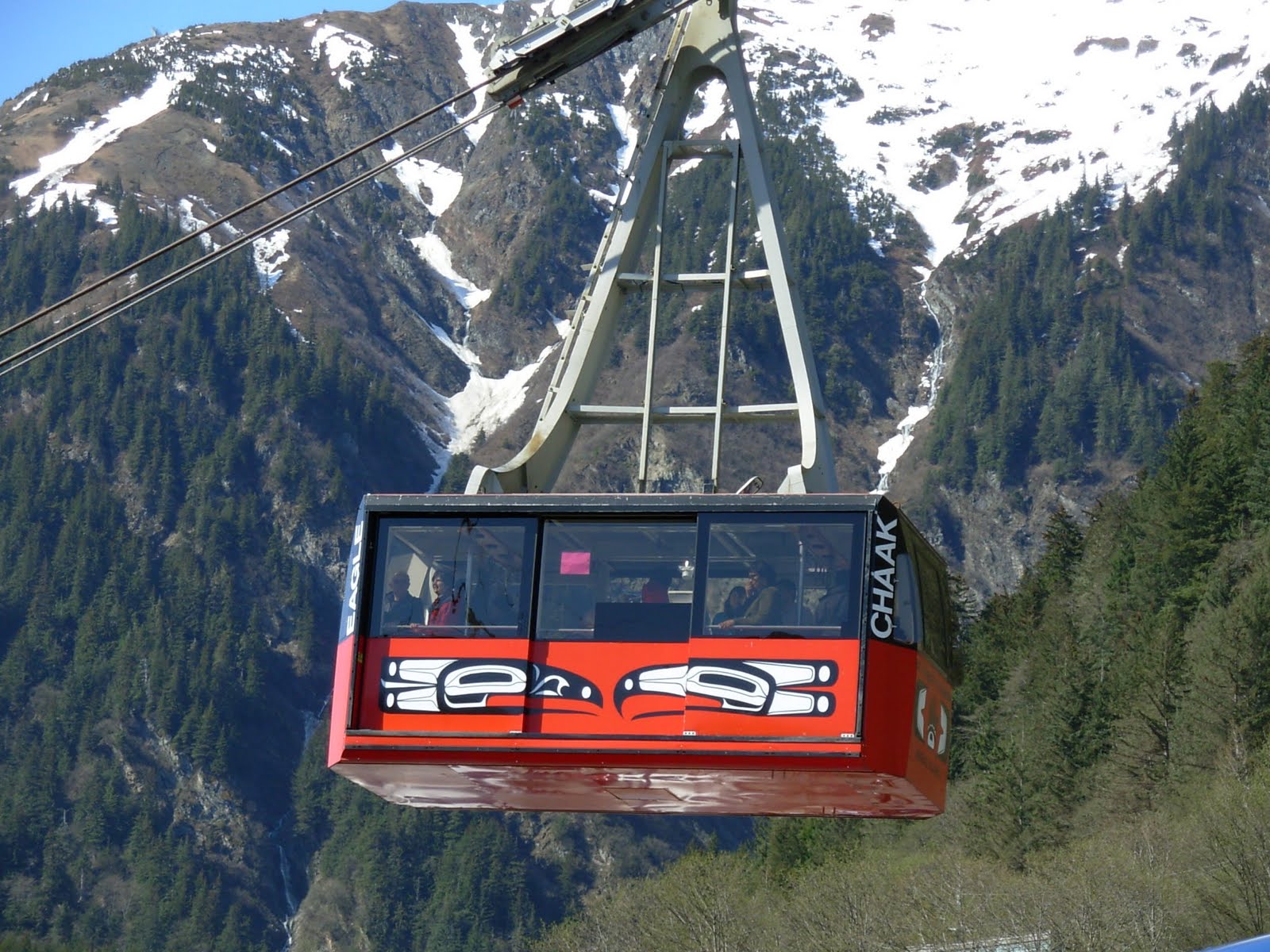
This picture demonstrates how closely downtown Juneau is built to the mountains:

That proximity makes the Mount Roberts Tramway a popular tourist stop. You can read all about it on this plaque:

This is what it looks like from the street:

And here is a close-up of the gondolas -- all sealed off from the cold weather:
We opted to NOT ride the tramway. Instead, we visited the Taku Smokeries. They had every variety of smoked salmon and related gee-gaws any tourist could ask for:

On our way back to the hotel in the afternoon, we spotted this one last form of wildlife in a downtown parking lot -- a porcupine! Apparently, these risky guys are pretty common in this area. They scavenge for food dropped by the tourists:

Ruth caught this close-up, all the while concerned about the porky possibly throwing his quills at her (a popular myth about porcupines):

We had to get a picture of the famous Red Dog Saloon with the snow-capped mountain behind it. We didn't visit either:

We were impressed with the murals that were painted on several buildings along the main street:

One final look at what is Alaska. Cruise ship, float plane, snow-caps and water. That says it all!

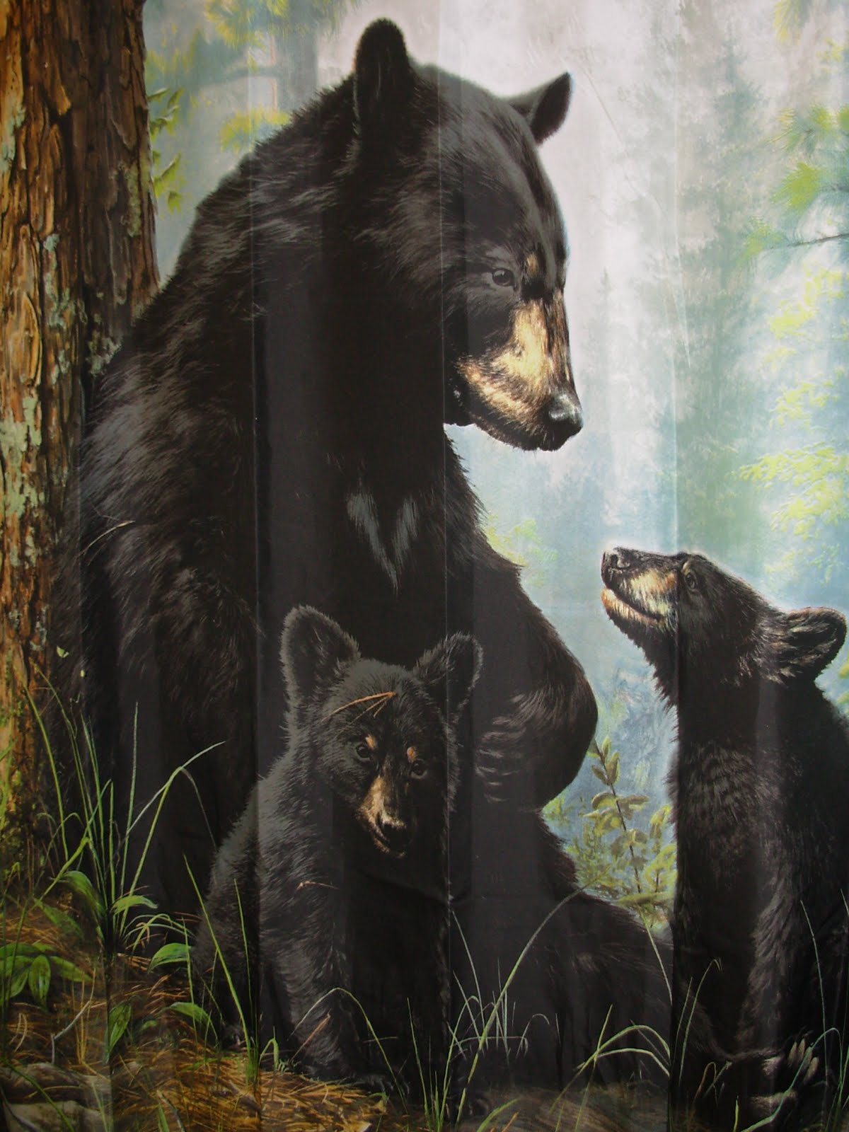
BUT! There was one more glimpse of wildlife. No this isn't a painting, nor real life. It is actually a picture of the shower curtain in our hotel room! No kidding!
We decided it would be fun to go out to dinner, so we had a quick happy hour and walked down to the Hangar on the Wharf for supper. The view out the waterfront window is spectacular (this picture is from their website (http://www.hangaronthewharf.com):

We each had a salmon steak with fresh steamed vegetables and a nice dry white wine. It was a great cap to the day.
After dinner, we walked back to the hotel and went to bed early. We had an early revile tomorrow...
And, to spare you another map, we are in the same place tonight as last night!
Monday, May 16, 2011
This was our "go-home" day. Our flight left at 8:00 am, so we were up early, packed and met the shuttle van at 6:00 am. This was our view out the window in the gate area of our flight to Seattle, where we would wait about four hours and take the flight to Atlanta:

Once airborne, Ruth got these pictures of the rugged Alaska and British Columbia terrain. It was very beautiful:


In a little while, the undercast all but blocked the view of the ground...

...until we let down on our approach to Sea-Tac airport in Seattle:

Back in the air, we flew across country and, as we arrived in the Atlanta area, this hazy view was all we were afforded. Welcome back to the sultry South:

We thought this trip was one of the best we had experienced, and hope to go back again someday for our third trip up/down the Inside Passage. We hope you have enjoyed our travelog!
Ruth and Bill